Case Studies
Patersons Surveyors: Skyline Queenstown $300M Redevelopment Case Study
Project Overview
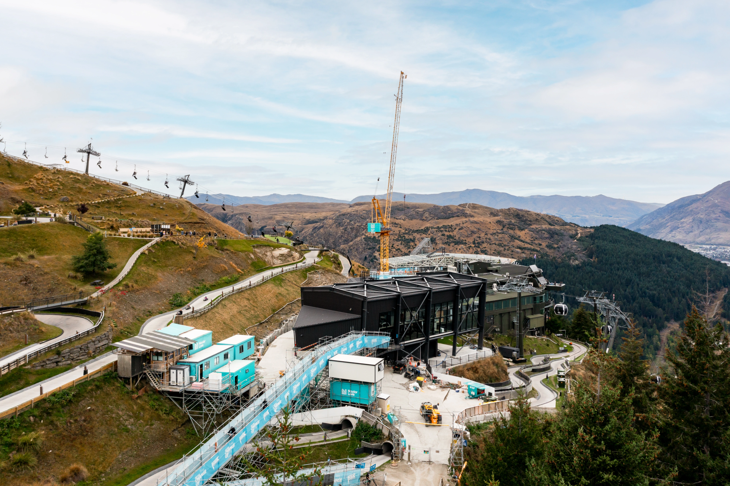
Set above Queenstown and visited by hundreds of thousands each year, Skyline Queenstown is undergoing a $300 million redevelopment. The multi-year, multi-stage project includes a new ten-seat gondola, a four-seat luge chairlift, expanded hospitality facilities including a larger Stratosphere Restaurant, and major supporting infrastructure upgrades.
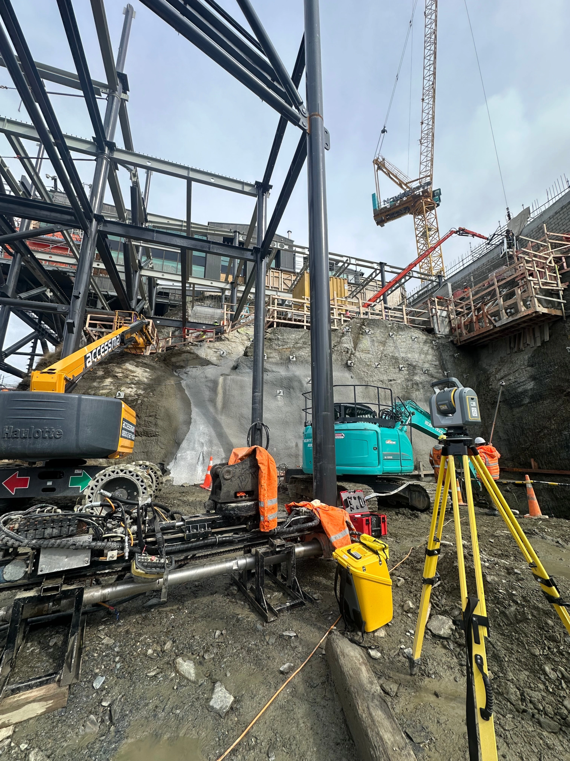
Patersons has provided surveying support across several components of the project, including the construction of a five-storey carpark requiring excavation of approximately 43,000 m³ of rock. Working alongside the construction team, Patersons supported foundation set-out, structural positioning, excavation monitoring and as-built verification across multiple stages of the works.
The Challenge
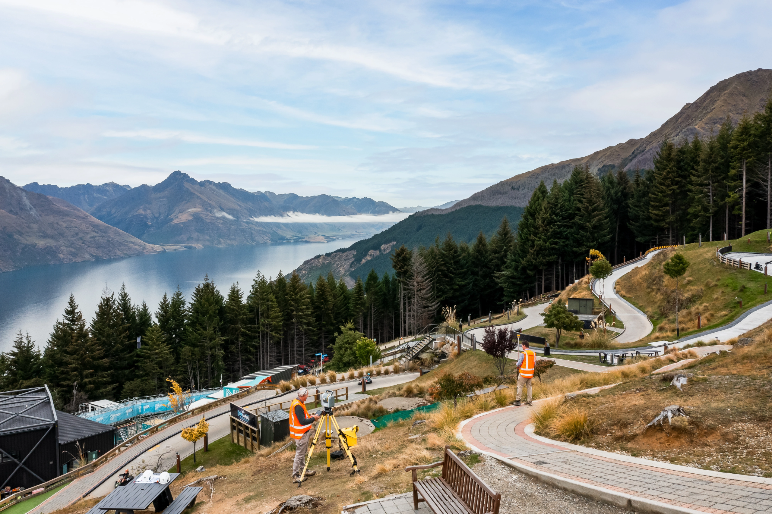
The Skyline site presents a number of surveying challenges due to its steep terrain and constrained construction footprint. The gondola alignment is among the steepest in the southern hemisphere, and there is limited flat ground available for construction.
For the carpark excavation, surveyors were required to work alongside rock faces up to 20 metres high while measuring irregular rock surfaces to determine monthly excavation volumes. At the same time, the team needed to set out and verify hundreds of rock anchors across complex rock faces, including 482 anchors installed at the lower carpark excavation and a further 674 anchors across the upper terminal and restaurant structures as the project progresses.
Construction was also staged around Skyline's ongoing operations, with the complex remaining open to visitors and the existing lifts operating for much of the construction period. Careful planning and precise survey control helped minimise shutdown periods while maintaining safe separation between construction activities and guests.
The Solution
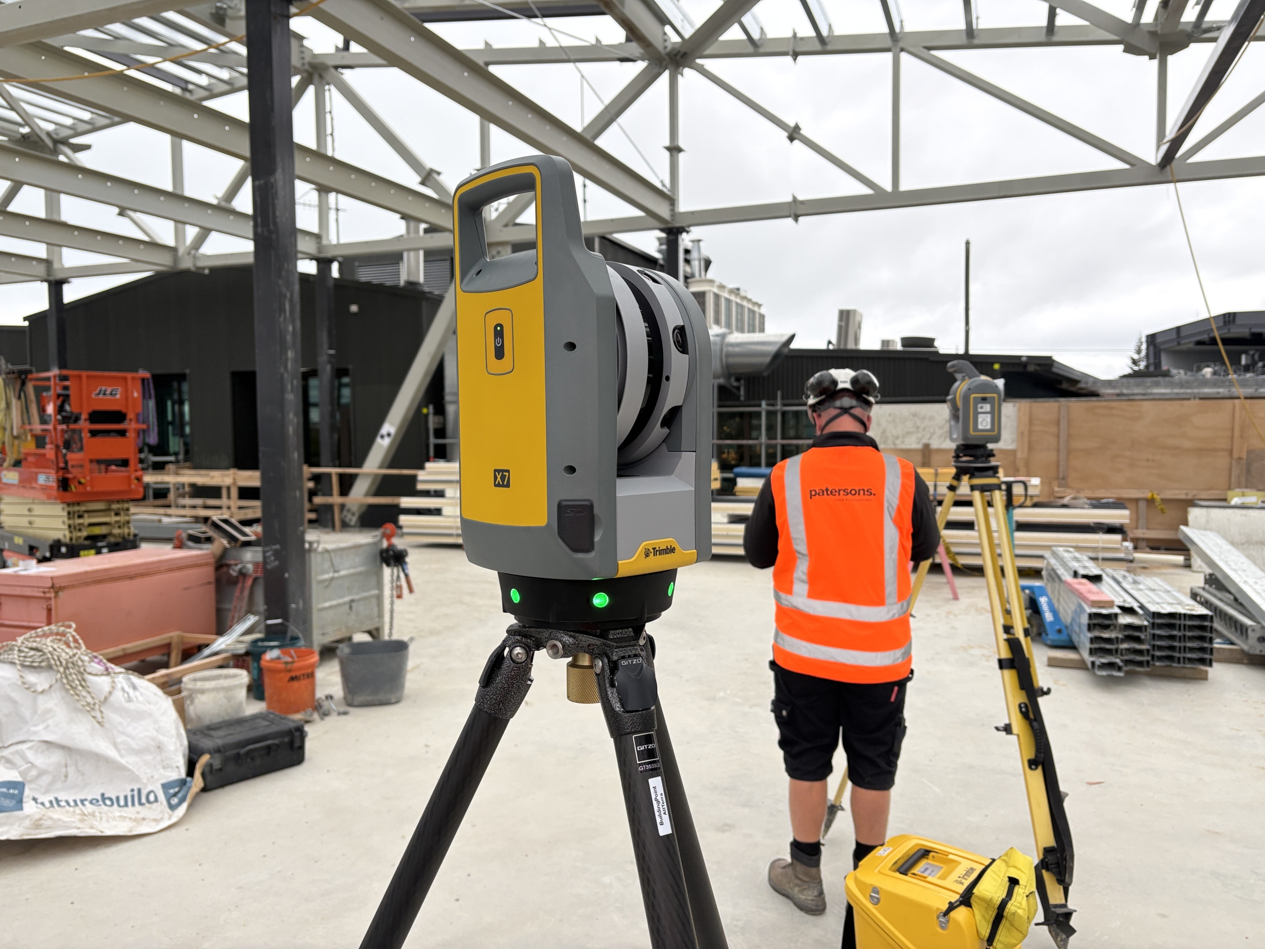
Patersons deployed a range of Trimble surveying and scanning technologies across the project, allowing the team to adapt their approach to the different challenges across the site.
Initial topographic surveys were carried out using Trimble R10 GNSS receivers and S6 robotic total stations, while the Trimble X7 scanner captured accurate records of existing structures to support design decisions.
During construction, R12i GNSS receivers established a precise control network across the steep site. S5 and S6 robotic total stations were used for the set-out of foundations, hold-down bolts and structural elements.
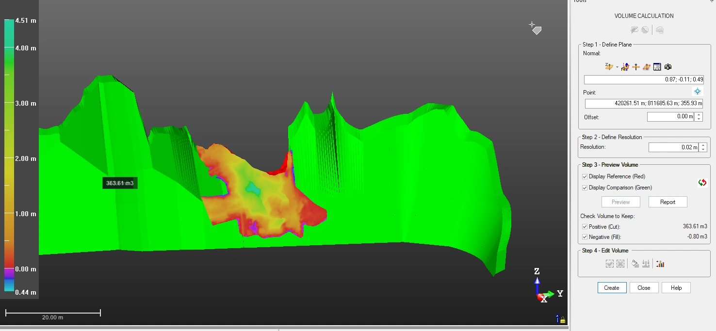
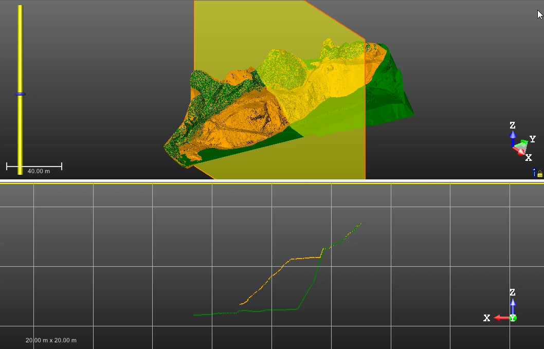
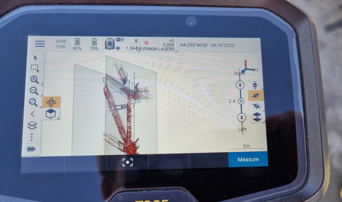
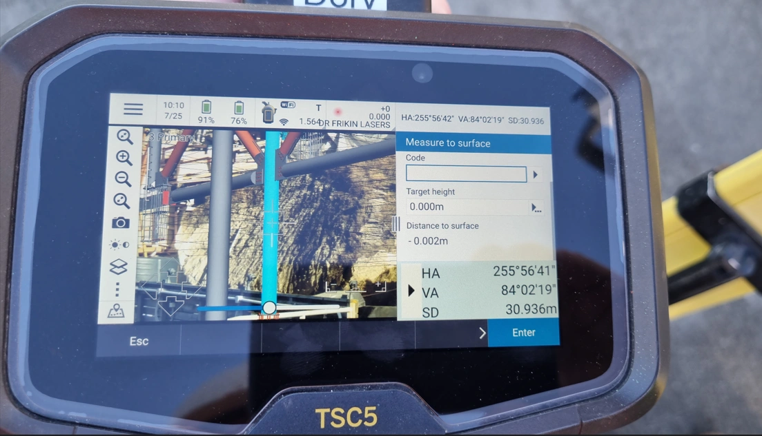
For the carpark excavation, the Trimble SX12 scanning total station proved particularly valuable. The team used the SX12 to capture high-density point clouds of the irregular rock faces, including overhanging areas and cave-like formations within the natural hillside. With a scanning range of up to 600 metres, the instrument allowed the team to capture detailed survey data from a safe distance, ensuring surveyors did not need to access hazardous areas below unstable rock faces.
Using the TSC7 controller, the captured point cloud data could be compared against design surfaces directly in the field. With the design IFC model loaded into the controller, surveyors were able to quickly identify areas requiring further excavation and discuss adjustments with the contractor on site.
The same SX12 setup was then used to set out rock anchors, allowing both scanning and set-out to be completed with a single instrument and controller, streamlining field workflows.
Captured scan data was processed using Trimble RealWorks, where point clouds were converted into detailed meshes capable of modelling complex rock geometries, including overhangs and cavities. By comparing the scans against a best-fit plane rather than a simple vertical axis, the team was able to generate highly accurate excavation volumes for the project's monthly measure-and-value reporting.
The Results
Across the carpark excavation works, integrated scanning and remote measurement technologies delivered clear safety, efficiency and accuracy benefits for the project team.
Remote measurement using the Trimble S5 and SX12 allowed surveyors to carry out set-out and as-built surveys from safe positions, reducing the need to access steep rock faces and significantly lowering risk to staff.
Scanning of excavation faces enabled the team to generate accurate monthly rock volume calculations for measure and value reporting. The ability to model the irregular rock faces and cavities within Trimble RealWorks provided highly accurate excavation quantities, which was particularly important given the costly scheduled items associated with drilling and blasting hard rock from the site.
The technology also delivered significant efficiency gains. The final scan of the lower carpark rock face was completed in under two hours from just three setups, enabling the accurate survey and as-built verification of 482 installed rock anchors. With some anchors located up to 27 metres above the excavated ground level, capturing this information remotely was both considerably faster and much safer than conventional survey methods.
"Having the ability to scan, compare against the design in real time, and then set out anchors using the same SX12 instrument makes a huge difference on a complex site like this. Working closely with the Allterra team has also helped us get the best out of the Trimble hardware and software, particularly with improvements in Trimble Access that make these tools even more effective in the field." Andrew Hughes, Engineering Surveyor at Patersons