A complete workflow from one supplier

  • Hardware

  • Software

  • Training

  • Support

With the improvement of technology and more flexible airspace regulation, UAVs are increasingly accessible, economical, and easy to use. 

UPG has been in the UAV industry for over 8 years and has a robust product offering from a number of industry-leading manufacturers.  With a specialist team who sell, train, support, and operate the UAV portfolio;  we’re excellently placed to help you understand what kind of solution might be appropriate for your project, how it can integrate into an existing workflow and what’s involved in developing or improving a UAV capability. 

Hardware

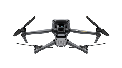
Mavic 3 Enterprise

Mavic 3 Enterprise Drone front view product image on a white background

The next generation < 2kg photogrammetry solution. Improved 20MP camera, very fast flight speed for faster mission completion with all the usual RTK/PPK options, ready to go in a complete kit.

DJI Phantom 4 RTK

Industry standard small/medium area survey system. Easy to use, Integrated mission planning, variety of RTK/PPK options 

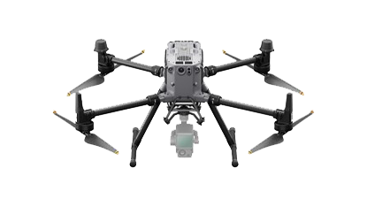
DJI Matrice 300 with P1 Camera or L1 Lidar 

Larger enterprise solution, integrated Lidar and office processing. Topo mapping through vegetation, powerlines, applications beyond photogrammetry  

senseFly Ebee X

senseFly eBee X

Large area fixed-wing survey, <2kg compatible, variety of payloads.

Software

Skycatch Edge Platform (SEP)

Suitable for either the DJI Phantom 4RTK and the DJI M300 RTK products

The Skycatch Edge1 Image Processing Base Station offers out-of-the-box centimeter accuracy in minutes!

Download Edge1 Product Spec Sheet
Download Edge1 NVIDIA Solution Showcase

Skycatch High Precision Package: Mining
Skycatch High Precision Package: Construction

Trimble Stratus/ Propeller

Trimble Stratus

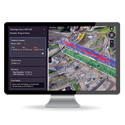
Simplify earthworks progress tracking across your site with industry leading cloud based processing, analysis and sharing.

The Propeller Platform is cloud-based drone survey visualisation and analytics software. Access the measurements and project data you need to do your job, without waiting on an expert.

Explore all the features and benefits of Trimble Stratus/ Propeller

TBC Aerial Photogrammetry

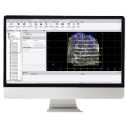
Import and process imagery from industry-leading unmanned aerial vehicles (UAVs) with streamlined workflows in TBC or customise the setup with the included Inpho UASMaster software.

Then utilise your survey-grade deliverables including orthomosaics, point clouds, and digital surface models with the CAD, surface, and other tools that TBC offers.

Download

Skycatch Vision Engine (SVE)

The Skycatch Vision Engine (SVE) is On-Premise Processing software package that allows users to process advanced Skycatch datasets (including large, high resolution scans of open pit high walls) even faster and without regard to internet bandwidth.

SVE runs on a powerful, custom-built Oryx Pro laptop by System 76.

High Wall Mapping Video
High Wall Mapping with Skycatch SVE Article
Webinar: The Art and Science of Highwall Scanning

FlyFreely 

FlyFreely Software Image on Laptop

FlyFreely is an industry leading drone management platform that manages all aspects of drone operations, compliance and fleet. The platform has been developed by operators for operators to meet both CASA’s Manual of Standards requirements and the operational challenges that surveyors face daily such as limited internet connectivity.

FlyFreely provides a simple, user friendly, all in one platform for your team to effectively manage your drones program compliantly and efficiently, so you can spend more time flying and less time on paperwork.

Overview Video 

Free Trial

PIX4D

PIX4D

The leading photogrammetry software for professional drone mapping.

Training

CASA <2kg category

Onsite training available, quick and easy way to get UAV operations started

CASA Licenced category

REPL for Pilots and ReOC for Company

Get started with Drones and take your work to the next level

A complete workflow from one supplier

With the improvement of technology and more flexible airspace regulation, UAVs are increasingly accessible, economical and easy to use.

UPG has been in the UAV industry for over 5 years and has a robust product offering from a number of industry leading manufacturers.  With a specialist team who sell, train, support and operate the UAV portfolio;  we’re excellently placed to help you understand what kind of solution might be appropriate for your project, how it can integrate into an existing workflow and what’s involved in developing or improving a UAV capability.

Hardware

Fixed Wing (large areas)

senseFly eBee X

The eBee X is the senseFly fixed-wing drone for all your mapping needs. Designed to boost the quality, efficiency and safety of your data collection, it has a camera to suit every job, the accuracy and coverage to meet every project’s requirements, and can work virtually every type of site.

Multirotor

DJI Phantom 4 RTK

Improved GNSS module on the most popular multi-rotor for aerial mapping.  UPG also offer a PPK workflow with the Trimble Stratus software package.  The streamlined workflow allows you to use an aero point as a base to achieve centimetre accurate data without the need of a reliable internet connection during your flight.

DJI Matrice 200 series V2

Built To Endure.  Engineered to Adapt.

The ultimate platform for aerial productivity combines a rugged design and simple configurability to work as a solution for a variety of industrial applications. Improvements to the M200 Series V2 enhance intelligent control systems, flight performance, and add flight safety and data security features.

eBee X fixed wing drone – Map without limits

[siteorigin_widget class=”WP_Widget_Media_Video”]“,”after_widget”:”<\/div>“,”before_title”:”

“,”after_title”:”<\/h4>“,”widget_id”:”widget-1-2-3″}}” />[/siteorigin_widget]

DJI Phantom 4 RTK – A game changer for Construction Surveying

[siteorigin_widget class=”WP_Widget_Media_Video”]“,”after_widget”:”<\/div>“,”before_title”:”

“,”after_title”:”<\/h4>“,”widget_id”:”widget-1-2-7″}}” />[/siteorigin_widget]

Introducing the Matrice 200 Series V2

[siteorigin_widget class=”WP_Widget_Media_Video”]“,”after_widget”:”<\/div>“,”before_title”:”

“,”after_title”:”<\/h4>“,”widget_id”:”widget-1-2-11″}}” />[/siteorigin_widget]

Software

Trimble Stratus

Cloud based software compatible with TBC

Pix4Dmapper

User friendly photogrammetry software

TBC/UAS Master

Integration with TBC allows powerful analytical tools and deliverable digitisation

Training

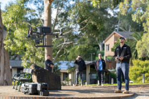
UPG is a training organisation approved by the Civil Aviation Safety Authority (CASA). The Flight School has been operating since 2013 and has assisted over 350 students to gain their Remote Pilot License. UPG’s experience in the geospatial industry allows our instructors to provide tailored training to suit specific applications such as aerial survey and asset inspection. UPG staff have a variety of backgrounds including Aviation, Surveying and Photogrammetry which allow us to provide a 365-degree training and support to our clients.

For more information on training, purchasing, license requirements, get in touch.

[siteorigin_widget class=”WP_Widget_Media_Video”]“,”after_widget”:”<\/div>“,”before_title”:”

“,”after_title”:”<\/h4>“,”widget_id”:”widget-4-1-0″}}” />[/siteorigin_widget]

Positioning Equipment

If you need to create accurate survey or mapping results, there are a number of methods to achieve real world absolute accuracy. UPG offers a variety of Trimble solutions for ground control point, PPK or RTK workflows.

[siteorigin_widget class=”WP_Widget_Media_Image”]“,”after_widget”:”<\/div>“,”before_title”:”

“,”after_title”:”<\/h4>“,”widget_id”:”widget-5-1-2″}}” />[/siteorigin_widget]

Support

There’s a lot more to using a UAV than charging the battery and getting in the air. Through its close relationships with manufacturers and distributors, dedicated support pathways and staff who have intimate technical knowledge; UPG offers the kind of support needed for the whole data capture and processing solution that a drone is part of.

[siteorigin_widget class=”WP_Widget_Media_Image”]“,”after_widget”:”<\/div>“,”before_title”:”

“,”after_title”:”<\/h4>“,”widget_id”:”widget-5-3-2″}}” />[/siteorigin_widget]

The right UAV for your needs

https://youtu.be/uabpL2WPLT0

Get the low down on our services

https://youtu.be/OzB0nwMERxc

Get your operations off the ground

https://youtu.be/Zj_FZ9GhME0

Talk to the experts and get your UAV operation airborne

https://youtu.be/NAZfByw9ewE

Follow us

White Paper

Comparing workflow and point cloud outputs of the Trimble SX10 TLS and senseFly eBee Plus drone

[siteorigin_widget class=”SiteOrigin_Widgets_Testimonials_Widget”]\u201cUPG Flight School assisted Melbourne Water in developing an internal drone program by providing the RePL course to 10 employees. The instructor’s experience with enterprise clients allowed us to implement drones in our operational workflow by successfully managing regulatory requirements and standard operating procedures. This has allowed Melbourne Water to minimise the exposure of our employees to locations of potential harm as we can now perform asset inspection works remotely in a safe and efficient manner.\”<\/em><\/p>\n”,”text_selected_editor”:”tinymce”,”url”:””,”link_name”:false,”link_image”:false,”new_window”:false},{“name”:”Glenn Collins, Goulburn Murray Water”,”location”:””,”image”:0,”text”:”

\u201cUPG Flight School provided valuable assistance inside the classroom, training twelve staff members in the RePL course, as well as supporting us on the field where required. UPG\u2019s experience as both a CASA approved training organisation and in commercial UAV operations simplified the process of obtaining the required licenses and implementing drones in our operational workflow.\u201d\u00a0<\/em><\/p>\n”,”text_selected_editor”:”tinymce”,”url”:””,”link_name”:false,”link_image”:false,”new_window”:false},{“name”:”Richard Nawara, Newcrest Mining”,”location”:””,”image”:0,”text”:”\"\"\u201cUPG Flight School trained six of our surveyors on Lihir Island in Papua New Guinea. UPG\u2019s experience in the geospatial industry provided insightful information and training on both the aviation regulatory system and best aerial surveying practices.\u201d<\/em>“,”text_selected_editor”:”html”,”url”:””,”link_name”:false,”link_image”:false,”new_window”:false}],”settings”:{“per_line”:1,”responsive”:{“tablet”:{“per_line”:2,”image_size”:50,”width”:800,”so_field_container_state”:”open”},”mobile”:{“per_line”:1,”image_size”:50,”width”:480,”so_field_container_state”:”open”},”so_field_container_state”:”closed”},”so_field_container_state”:”open”},”design”:{“image”:{“image_shape”:”square”,”image_size”:50,”so_field_container_state”:”open”},”colors”:{“testimonial_background”:false,”text_background”:”#f0f0f0″,”text_color”:”#444444″,”so_field_container_state”:”open”},”padding”:10,”border_radius”:4,”user_position”:”left”,”layout”:”text_above”,”so_field_container_state”:”open”},”_sow_form_id”:”5593402115b83724e5e1ac461999077″,”_sow_form_timestamp”:”1554861794106″,”csb_visibility”:{“action”:”show”,”conditions”:{“guest”:[],”date”:[],”roles”:[],”pagetypes”:[],”posttypes”:[],”membership”:[],”membership2″:[],”prosite”:[],”pt-post”:[],”pt-page”:[],”pt-product”:[],”pt-portfolio”:[],”pt-tribe_events”:[],”pt-essential_grid”:[],”pt-trainer”:[],”tax-category”:[],”tax-post_tag”:[],”tax-post_format”:[],”tax-product_cat”:[],”tax-product_tag”:[],”tax-product_shipping_class”:[],”tax-portfolio_category”:[],”tax-portfolio_tag”:[],”tax-tribe_events_cat”:[],”tax-essential_grid_category”:[]},”always”:true},”csb_clone”:{“group”:4,”state”:”ok”},”so_sidebar_emulator_id”:”sow-testimonials-1141310043″,”option_name”:”widget_sow-testimonials”},”args”:{“before_widget”:”

“,”after_widget”:”<\/div>“,”before_title”:”

“,”after_title”:”<\/h4>“,”widget_id”:”widget-9-0-0″}}” />[/siteorigin_widget]

The Team

While Kieran and Lorenzo ARE the UAV team, across the three companies we have the benefit of working with a number of key, experienced partner business to offer the best solutions in the Geospatial, Civil Construction and Mining, and Buildings industries.  If you have any questions or want to find out more, just get in touch.

Lorenzo Forte
Chief Remote Pilot, Chief Flying Instructor and Maintenance Controller

Lorenzo joined UPG Flight School in April, 2016 and runs the CASA-approved RePL course, among many other roles.
He also develops material for the RePL and drone courses, and manages a team of four remote pilots and a fleet of 10 remotely piloted aircraft.
Lorenzo came to Australia from his native Italy in 2010, where he spent three years in the Italian Navy.
He has a Bachelor of Aviation Science from Griffith University in Brisbane, which he attained in 2014.
With more than six years of customer service in a number of roles both within the industry and in other fields, Lorenzo says he enjoys assisting clients and their businesses integrate drone technology into their operations.

Kieran Dinuzzo
Technical Consultant

Kieran has been with the flight school since February 2017.
He Is a drone instructor with a high level of skills in assisting clients collect data in the field and obtain photogrammetry outputs.
He is also conducts much of the school’s software training courses.
Kieran holds a Bachelor of Science majoring in Geography from the University of Queensland.
Customer service is a passion for Kieran and he enjoys employing his problem-solving skills to meet clients’ needs from the variety of hardware and software the flight school offers, as well as training to ensure the tools deliver to the highest level.